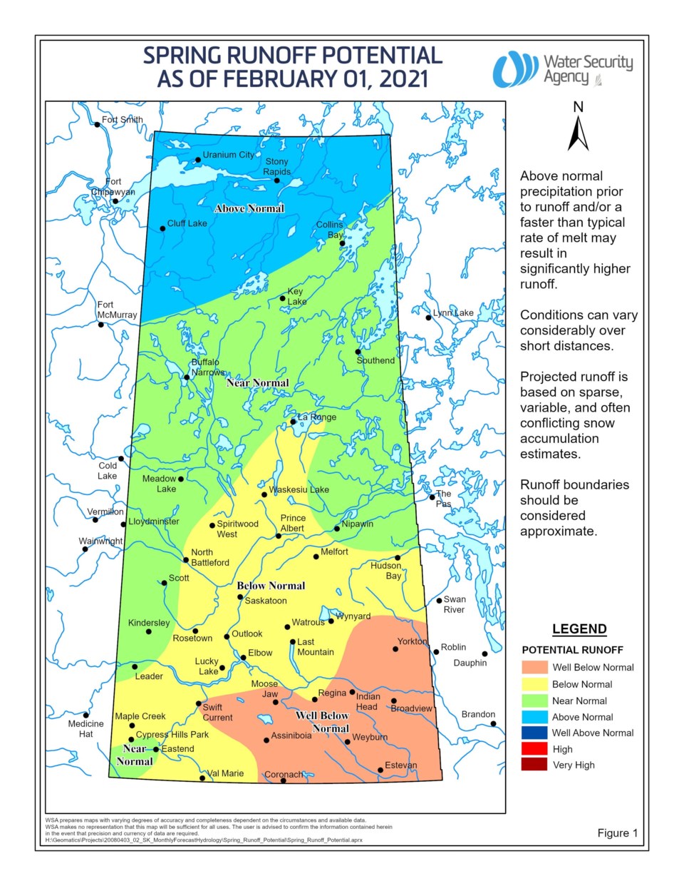
The Water Security Agency (WSA) has released the preliminary spring runoff outlook for 2021, showing most of southern Saskatchewan with below to well below normal snowmelt runoff potential and the northern areas looking at normal to above normal potential.
Much of the southern areas of Saskatchewan experienced very dry conditions through the summer and into fall last year. The snowpack is generally below to near normal to date. An area covering Prince Albert, Saskatoon, Melfort and dipping as far south as Maple Creek and Val Marie is projected to have a below normal runoff, while an area covering Moose Jaw, Regina, Weyburn and Estevan is looking at a well below normal runoff.
The far north, encompassing the areas of Uranium City, Stony Rapids and Cluff Lake, saw extreme wet conditions carrying through the fall. This area also experienced historically high lake and river levels through summer 2020. There are indications that the snowpack is near normal, though data is limited. An above normal runoff is forecast.
Areas of central and northern Saskatchewan including Kindersley, Lloydminster, Meadow Lake and Nipawin are currently expected to experience a near normal runoff. While fall conditions were near to slightly drier than normal, a near to above normal winter snowfall season to date, including a heavy snowfall in early November, have been compensating factors. The far southwest corner of the province, from Cypress Hills to the US border, is also expected to experience a near normal runoff.
The spring runoff outlook could change as there is potentially another 8-10 weeks of winter remaining. The first spring runoff forecast will be issued early in March.


