Environment Canada
Canada is warming at nearly twice the global rate with parts of western and northern Canada warming three or four times the global average. Sea ice in the North is thinning and shrinking, and our unique ice shelves are crumbling into pieces. While Canada is still the snowiest country, less snow is falling across the south. White Christmases’ are less frequent and less white. Frost-free days are increasing, and our growing season is longer, but so too is the length and severity of the wildfire season. Weather systems are moving slower, leaving more time to make an impact. When it rains it often rains harder and longer. Records continue to topple like never before, often dramatically shattering previous records. So-called unprecedented events are becoming common, happening back-to-back, not decades apart. Our “Goldilocks” weather is not so sure any more with conditions being either too hot or too cold and too wet or too dry.
Scientists have made a clear link between climate change and extreme weather events that include heat waves, wildfires, some flooding and sea ice loss, and strong possibilities for linkages to heavy rain, icing, drought and storminess. As Canadians continue to experience more extreme weather, these top news events will simply, decades from now, be called “normal”. As the Top Ten Weather Stories of 2020 bear out, exceptional weather which we thought was futuristic is occurring here and now. It is playing out in our backyards, in our communities and in our country. What 2020 showed, through smoky skies in British Columbia, frequent hurricanes in the East, and vanishing ice in the North, climate change occurring elsewhere outside of Canada is also having an increasingly greater impact on the health and well-being of Canadians at home.
Across Canada, 2020 was another year of destructive and impactful weather. Property damage from weather cost Canadians millions of dollars and the economy billions. Based on preliminary estimates compiled by Catastrophe Indices and Quantification Inc. (CatIQ), there were nine major catastrophic weather events, with total insured loss estimates approaching $2.5 billion. But that was only a fraction of total property losses and infrastructure costs from major and nuisance weather costing billions more.
From a list of 100 significant weather happenings across Canada in 2020, events were ranked from one to ten based on factors that included the degree to which Canada and Canadians were impacted, the extent of the area affected, economic and environmental effects and the event’s longevity as a top news story.
Top ten weather events in 2020
10. August long-weekend storms: East and West
The civic long weekend in August featured some nasty summer weather in both southern Alberta/Saskatchewan and in Ontario. First, in the East, a low-pressure system crossed through central Ontario late August 1 through August 2. The warm front associated with the system brought significant tropical-sourced moisture between 50 and 70 mm from Windsor to the Greater Toronto Area and Niagara, and along the north shore of Lake Ontario. Rainfall in Barrie totalled between 80 and 90 mm, more than the average monthly total, and the highest of any August one-day rainfall in history and the most one-day amount for any month in 25 years. A couple of volunteer observers reported in excess of 100 mm of rain in Western Ontario. The storm system spawned four tornadoes with winds clocking between 130 and 190 km/h.
In the West on August 2 and 3, pulses of energy in the midst of hot and humid air destabilized the atmosphere, resulting in several robust storms, featuring large tennis- and baseball-sized pulverizing hailstones. Strong thunder cells also produced damaging wind gusts and heavy rainfall that triggered localized flash flooding. Large hailstones inflicted extensive property damage in Crossfield, Alberta near Carbon, from Cremona to Drumheller, and at a campground northwest of Calgary. Winds in excess of 100 km/h inflicted damage to trees and dwellings in Killam, southeast of Edmonton and at Forestburg. In Macklin, Saskatchewan storm winds took down trees and power lines and tore off a hotel roof. Hail cracked several windows and windshields, damaged siding on several buildings in town and scarred golf course greens. Costs of this August hailstorm in Alberta and Saskatchewan included 4,000 insurance claims totaling $55 million in property losses. Amidst the storm, three non-damaging tornadoes occurred including one at Youngstown and two near Dorothy, Alberta.
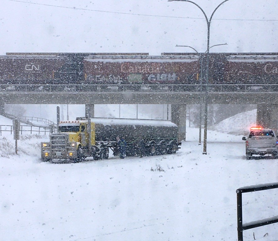
9. Fall in Canada – winter in the West and summer in the East
Across much of the Prairies residents welcomed unseasonably warm weather during the first week of November, but with an eye on a powerful storm lining up to the West. From November 7 to 9, the summery interlude came to a dramatic end with the arrival of a slow-moving, moisture-laden Colorado low from the American northwest. Strong winds with gusts up to 85 km/h ushered in the storm and combined with falling temperatures to produce wind chill values of -22. Moreover, the storm featured a mixture of heavy snow and rain and/or a congealment of ice pellets and freezing rain, prompting lockdown conditions from southwestern Alberta (south of Calgary) through central and southern Saskatchewan, and into northwestern Manitoba. It was mostly snow in Alberta and central Saskatchewan with record-breaking amounts drifting and blowing about in sudden whiteout conditions. Saskatoon, Prince Albert and Kindersley, Saskatchewan took the biggest hit with 50 hours of snowfall (30 to 47 cm), much of it blowing around. Maple Creek and Swift Current, Saskatchewan were buried in 2-metre drifts. In southeastern Saskatchewan and in southern Manitoba prolonged periods of freezing rain and ice pellets kept snowfall totals down but added to the treacherous driving conditions. Residents were prepared for the well-publicized winter blast, but, the wintery nightmare created significant impacts with damage to leafed trees and power lines. Travel was nearly impossible and dangerous with sudden reduced visibility. New snows made most surfaces icy and slippery. Local businesses, community centres and schools closed early or never opened at the beginning of the week as dense snow choked streets and highways.
In contrast, at the end of October and in early November, southern parts of Ontario and Quebec had a taste of winter with the season’s first snowfall and biting frosts. But summer weather made a quick return with an unprecedented long stretch of record-breaking high temperatures across Ontario, parts of southern Quebec, and eventually into Atlantic Canada beyond Remembrance Day. Over a remarkable stretch of eight days 200 daily high temperature records were set from Ontario to Newfoundland with some readings eclipsing the previous record by several degrees. On November 9, the temperature in Collingwood, Ontario soared to 26°C --- one of the highest temperatures ever in the province for November and the warmest November day in 60 years.
8. Frigid spring helps Canadians self-isolate
It is often said that spring is reluctant to arrive in Canada. In 2020, spring was not late; it went missing. Following a mild winter, the weather turned cold across most of southern Canada in March and persisted for another two months. At times, negative temperature anomalies were extraordinary, reaching as much as -22 degrees in parts of Alberta at the end of March. Most of the blame goes to the polar vortex which for most of winter remained at home, circulating the North Pole before sagging southward in March bringing with it an expansive cold air mass. More than 80% of Canada had a colder than-normal spring. April was especially cold and cruel being the sixth coldest April in 73 years in the Prairies and southeastern Canada. April felt like late-November with double-digit negative highs and wind chills pushing –35 in central Alberta. The cold spell continued into the first half of May. Temperatures felt more like early March than early May; and Mother's Day more like St. Patrick's Day.
The lingering spring-time chill, along with May snows, fit the mood of the nation, frozen in place. In some ways, Mother Nature made it easier for Canadians to self-isolate indoors to prevent the spread of COVID-19. Mother Nature joined with public health officials to keep people dutifully two metres apart in the warmth of their own homes. Further, on May weekends, because people who normally went away to cottages or cabins tended to stay put, there was a slower start to the wildfire season compared to most.
7. The year’s most powerful tornado
In a year with at least 77 tornadoes across Canada, the highest rated and therefore the most powerful tornado occurred on August 7 in southwestern Manitoba near the rural municipalities of Pipestone and Sifton. On August 6, individual storm cells produced large hail, powerful winds and torrential downpours in Alberta. The next day, the low-pressure system shifted eastward posing a threat with large hail, heavy rains, and damaging winds through the afternoon and early evening hours in eastern Saskatchewan and western Manitoba. Environment and Climate Change Canada issued a tornado warning at 7:49 pm and five minutes later a monster funnel cloud filled the sky and grounded as an EF-3 tornado near Scarth, 13 km south of Virden, Manitoba. Violent winds blew over 200 km/h lasting between 10 and 15 minutes, leaving a 9-km long damage trail of farm buildings, chewed up grain silos, crushed steel fertilizer bins, snapped trees, felled powerlines and wooden utility poles, with scattered debris across yards and fields.
A man from the Sioux Valley Dakota Nation witnessed the twister’s ferocious strength when winds uprooted a pine tree and tossed it onto his Jeep’s roof seriously injuring him. Within seconds, winds blew out the vehicle’s windows and started rolling it for 150 m before it settled in a ditch. At the scene, he witnessed the tragic sight of the tornado lifting a pickup truck and tossing it a kilometre away. Police and other first responders found the crushed truck. Tragically, its two teenage occupants from nearby Melita, Manitoba had been ejected and did not survive. The Scarth tornado was the strongest twister recorded in Canada in 2020, reaching wind speeds estimated as high as 260 km/h.
6. Record hurricane season and Canada wasn’t spared
Meteorologists predicted another “active” Atlantic hurricane season in 2020, but a record season was more like it! The tally at the official end of the season was 30 named storms, 13 hurricanes of which 6 became major hurricanes– approaching three years’ worth of storms in one. Named storms went from Arthur to Wilfred and started again from Alpha to Iota. The “hyper” storm season reflected a warm multi-decadal cycle of high storm activity that began in 1995 and broke the record for the number of named storms in a single season set back in 2005. As forecasters are getting better at detecting even weaker storms, it was no surprise that once again a couple of them showed earlier on the map. For the record sixth year in a row, a named storm formed in the Atlantic basin prior to the official start of the season.
5. St. John’s “snowmageddon”
Meteorologists called it a bomb cyclone, where a storm’s atmosphere dropped 24 hPa (degrees of pressure) in 24 hours. For townies in St. John’s, Newfoundland and Labrador it was “Snowmageddon” – the fiercest blizzard of a lifetime in a city known for its punishing winter storms. On the morning of January 16, a deep low-pressure system situated in western New York tracked through the northeastern United States before continuing onwards to Newfoundland’s Avalon Peninsula - a normal track for a mid-winter storm. For much of the next day, the storm deepened and strengthened to “bomb” status, its pressure dropping more than 54 hPa in 48 hours. Snow began falling early on January 17, intensified during the day, before easing up later overnight. Blizzard conditions prevailed for 18 straight hours with visibilities of 200 metres or less. St. John’s International Airport broke its historic daily snowfall record with 76.2 cm and had to stay closed for six days. Nearby, Mount Pearl and Paradise reported 90 cm of snow over 28 hours. Snowfall intensity of 10 cm an hour was impressive. The last time St. John’s saw something close to 75 cm of snow was in April 1999, when the pre-storm ground was snow bare. The January storm started with 40 cm of snow already sitting on the ground. In fact, for 27 days starting on Christmas Eve there was only one day without snowfall, New Year’s Eve, for a total of 220.8 cm in that period. Winds on January 17 were also impressive, reaching hurricane force at 160 km/h along the coast. The deep low and strong winds also generated a significant storm surge with a wave height of 8.7 m on January 18, damaging docks, wharfs and yachts. But it was all about the snow! Most times you couldn’t tell if it was snowing or just blowing around. Monster drifts were higher than doorways, which meant people often had to dig from the inside out. The super-sized storm left piles of snow higher than houses. The city was entombed in snowdrifts. There was even an avalanche in the middle of downtown. St. John’s, claiming to be the snowiest major city in Canada, earned its reputation and declared a state of emergency along with 11 other nearby communities. This marked the city’s first in 36 years - which lasted more than nine days. Another 10 to 20 cm of snow fell over the next days making cleanup efforts even more challenging. That is when 625 Canadian Armed Forces personnel arrived for a week or more to help dig out the city by clearing roads, attending to the elderly and sick and ensuring residents got medical care.
Plugged narrow streets became an enormous struggle for crews cleaning more than 14,000 km of city roads. Power outages occurred to more than 20,000 hydro customers. All businesses were ordered closed and all vehicles except emergency ones were prohibited from operating. Even government snowplows were taken off the streets. Mail delivery was halted but even when resumed, mailboxes were buried; blood donor clinics closed; even funerals had to be postponed. Homeowners ran out of supplies and lined up at grocery stores five days after the storm ended when they were able to reopen. Insurer costs exceeded $17 million, covering only a fraction of snow removal costs and economic losses. The monster snowstorm on January 17 was the big talk for weeks in the city, but it also made news worldwide from the United Kingdom to Turkey to Australia. With 12 days to go in January, St. John’s broke the record for their snowiest January since records began, totalling 166 cm from January 1-19, 2020. No wonder the local townies called it Janubury.
4. Endless hot summer in the East
Following a cold spring with frost and snow in the first half of May, the weather in Central and Eastern Canada soon turned from slush to sweat. The long weekend in May - often the unofficial kick-off of summer - proved prophetic and a trendsetter. In Eastern Canada, it was the summer of summers – coming early and staying warm until almost Labour Day. Overall, it was either the fourth or fifth warmest summer in 73 years and the warmest since 2012. Temperatures started exceeding 30°C on May 25 and humidex values soared close to 40 in Ontario, Quebec and New Brunswick.
On May 27, Montreal hit 36.6°C, its hottest May temperature ever. In fact, it was the second-highest reading ever in Montréal! The only hotter day in 15 decades was 37.7°C on August 1, 1975. In Quebec, 140 temperature records were eclipsed in June, and July saw even more records broken. Incredibly, Sept-Iles touched 36.6°C on June 18th – an all-time record for the area. Before the second week of July, Ottawa had already as many days above 30°C, with four exceeding 35°C, as it would normally see an entire summer. Normally such sizzle occurs once every 10 years, not four times in one summer. July 2020 wasn’t the hottest July on record at the Ottawa International Airport, but you'd have to have been alive in 1921 to have experienced a more sweltering one in the city with records dating back almost to Confederation.
With the kind of summer Ontario had, it was not a surprise that the Great Lakes were as hot as a hot tub. Surface water temperatures ranged between three and five degrees higher than normal except for larger and deeper Lake Superior. According to satellite reconnaissance on July 10, Lake Ontario's average surface temperature reached around 25°C - a record this early in summer and on par with the highest temperatures in any month since satellite data collection began.
3. Fort McMurray’s flood of a century
For the second time in four years, residents of Fort McMurray, Alberta were forced out of their homes. This time it was water, not fire. Severe ice jamming on a 25-km stretch of the Athabasca River caused water to back up on the adjacent Clearwater River, flooding much of downtown at the end of April. It was said to be the most significant flooding in more than a century. In a matter of hours on April 26, ice clogging raised water levels on Fort McMurray area rivers between 4.5 and 6 metres. The sheer size of the ice prevented the use of common ice-jam breaking options, such as explosives. Instead, what nature started, nature had to stop. An unprecedented two months of extreme cold as much as 10 degrees below normal, followed by a week of rapid warmth, lots of sunshine and warm rains prompted continued melting of the ice exacerbating the flood but continuing to mitigate it too. For more than a week, 13,000 residents in the lower townsite of Fort McMurray had to evacuate. Another ice jam on the nearby Peace River forced 450 people from their homes in Fort Vermilion, Alberta. Many customers went without power or gas service for nine days. States of local emergency and boil water advisories were in effect in both Fort McMurray and the surrounding municipality adding to the state of emergency declared a month earlier due to COVID-19. Some residents were forced out of their homes after weeks of isolation due to the pandemic. Emergency measures officials did a remarkable job managing evacuations in one of the world’s first natural disasters during a public health crisis. In spite of the efforts of thousands of volunteers and workers engaged in bailing and sandbagging to protect infrastructure including the hospital, essential businesses were unreachable in the submerged downtown core, and only a handful of grocery stores remained open, causing a strain on supply. Tragically, a man from the Fort McKay First Nation, about 60 kilometres north of Fort McMurray, drowned after he and another were caught by rising waters of the Athabasca River. Most water damage was to commercial property downtown where 1,230 structures were damaged from both overland flooding and sewer backup. Hundreds of abandoned cars and trucks were completely submerged. Huge ice chunks and piles of silt lay on the golf club and two small bridges on the course were smashed. The Insurance Bureau of Canada estimated the cost of the flooding from nearly 3,000 claims totalled above $562 million with 90% paid out to commercial properties.
2. BC’s September skies: all smoke, no fires
Statistics from the Canadian Interagency Forest Fire Centre reported a second consecutive quiet fire season across British Columbia in 2020 following two of the busiest years ever in 2017 and 2018. The number of fires province-wide this year was down to 629 or a third of the fires in the record year of 2018. Most shocking, burned hectares of woodlands were only 1% of that consumed two years earlier and 4% of the average areal burn over the past decade. Whereas there were only a few home-grown fires, owing to a cooler and wetter spring, there was a record amount of imported wildfire smoke in September. Visible from space, dense smoke plumes from forest fires in the U.S states of Washington, Oregon and California travelled northward into British Columbia’s southern airshed. Residents from Victoria and Vancouver east to Kamloops, Kelowna, and in the Kootenay region faced some of the worst air quality in recorded history and some of the poorest and unhealthiest air in the world. For eight consecutive days in mid-September, about four million British Columbia residents, urban and rural, and young and old smelled smoke and breathed foul air. Special Air Quality Statements were issued by Environment and Climate Change Canada, as air-cleansing rains and pollution-dispersing marine winds were absent in the first half of September. Beautiful British Columbia didn’t look so beautiful! Residents with underlying respiratory and cardiovascular conditions were especially vulnerable, as the fine particulate matter was six times levels registered from the home-grown fires of 2017 and 2018. The long-term health effects for all residents are unknown. Vancouver and Victoria were especially dark and smoky. Vancouver recorded 171 hours of smoke and haze in September with one bout that lasted 120 consecutive hours over four full days from September 12 to 15. Victoria was no less impacted with 195 hours of smoke/haze, including 186 consecutive smoke-filled hours around the 15th of the month. Both cities registered 70% to 80% more smoky hours above their previous record numbers from August 2018.
Around the Labour Day weekend, a high-pressure system building over northern British Columbia produced strong gusty winds over the southern half of the province. The same weather system ushered in a couple of days with record high temperatures warmer-than-normal and pulled in smoke from massive fires burning across the border from the United States. A dense, fog-like shroud turned daylight into smoke-tainted twilight, blue skies to leaden grey with an acrid-burning smell and sunrises an eerie blood red. Smoky skies bulletins for the southwest prevailed for 11 days, compounding a public health crisis already posed by the COVID-19 virus. At times, the thick layer of smoke aloft prevented sunshine from getting in and heating up the ground thus chilling temperatures by 6 to 10 degrees across the West. Around September 18, a fall frontal system from the Gulf of Alaska brought rains and winds to the Coast to start flushing out the smoke and improving breathing. Wildfire smoke wafted across the border into Alberta. Calgary was spared but smoky skies prevailed in southwest Alberta, near the Rockies. Further east, satellite imagery on September 14 and 15 showed plumes of smoke drifting across the country extending as far as Europe. American wildfire smoke moved back into southwest British Columbia on September 30 for a very short time, but the air quality was nowhere as bad as it was earlier in September.
1. Calgary’s billion-dollar hailer
Calgary, Alberta endured more than its share of stormy summer weather in 2020. The season featured frequent hailfalls with grapefruit-size stones, powerful wind speeds, tornado scares, dark funnel clouds, lightning-filled skies, torrential rains, and flash flooding. The city lived up to its reputation as the hailstorm capital of Canada. The Insurance Bureau of Canada sees hail as such a threat in the city that it sponsors a cloud-seeding program in order to diminish the size of urban hailstones – a pea-size stone does much less damage than ones the size of tennis balls. The June 13 hailstorm was Canada’s costliest and the fourth most expensive insured natural disaster in history with Canadian insurers estimating the dollar value of the 63,000 claims (minus crop losses) at about $1.3 billion. More than 32,000 vehicles were extensively damaged with cracked and smashed windshields with vehicle write-offs totalling $386 million.
As was frequently the case this summer, on June 13 warm, humid air was positioned over Alberta generating multiple rounds of severe thunderstorm cells. With colliding winds at various heights over southern Alberta, the resulting wind shearing kept the large, long-lived thunderstorms going. Around 7 p.m. MDT, a hail core scraped over northeastern Calgary, visibility dropped to half a kilometre, and temperatures fell 5 degrees in less than six minutes. Hail the size of tennis balls and golf-balls ricocheted out of the sky propelled by wind speeds up to 70 km/h. Pounding hail shook houses, broke windows and downed trees. Crashing hail dimpled vehicles and riddled house siding with millions of dents. The violent hailstorm smashed skylights, flattened flowerbeds and turned backyard vegetable gardens into coleslaw. Streets and intersections were flooded, and manhole covers were lifted. In its wake, slushy hail drifts 10 cm deep piled up along highways, and were still evident the next day. Power outages knocked out service to more than 10,000 customers. Train and bus services were suspended due to flooding. Outside the city, the massive hailstorm decimated hundreds of thousands of hectares of young wheat, canola and barley.
Regional weather highlights and runner-up events in 2020
National
Another “not-cold” year in Canada – 24 in a row
Quiet Canadian wildfire season
Arctic Ocean – more water than ice
Canadian ice shelves melting away
Atlantic Canada
Rough landing in snowy Halifax
Winter’s first big storm slams Eastern Newfoundland
Record January snowfall in Sydney
Newfoundland’s stormy February
Powerful storm brings down a dome in Cape Breton
Blustery winds punish Maritimes at end of February
Easter Friday weather bomb
Flooding again on the Saint John River?
Foul weather on Mother’s Day
Microburst and century flooding strikes Fredericton
Spring-summer dryness in the Maritimes
Big snow in “Big Land”
Québec
Winter’s first storm with all kinds of precipitation
Snow to celebrate
February snows gridlock Québecers
Late February storm and surge at Québec City and eastward
Late winter flood threat
Easter weekend features snow, surges and coastal flooding
Wildfires out of control in the Saguenay
Microbursts and Québec’s first tornado
Flooding rains and hail inflict major losses
More tornadoes and flooding in July
Pre-Thanksgiving hail and wind costs millions
Ontario
January’s weekend storms – three in a row
Rideau Skateway’s 50th season – never fully opens
Texas storm turns on lake-effect snow engine
Heavy rains and wind-driven flooding around Victoria Day
Summer’s first heat wave fuels severe thunderstorms
More tornadoes in Ontario. Perhaps?
Flash flooding in Toronto’s west end closes beaches
Ontario wildfires confined to Red Lake region
Dry land farming
Record number of waterspouts on the Great Lakes
Three-day rain event across Ontario
Another year of high Great Lakes water levels
Summer’s last hurrah with storm in October
Witches of November storm
Prairie Provinces
Brutal cold, even for the Prairies
Widespread June wind-hail-rain in Saskatchewan
West Manitoba June Deluges
Tornado day in Saskatchewan
Northern Saskatchewan too wet for grain and rice producers
Thought to be tornadic, straight-line winds strike Manitoba
Edmonton rainstorm floods hockey venue
Calgary’s other hailstorm
Finally, summer heat in the Western Prairies
Big trough country
“Great” harvest with some exceptions
Pre-winter weather chills the second half of October
Weather dome over the west
British Columbia
BC’s atmospheric river
Toughest part of winter in mid-January
Soggy storm raises water flows and levels
Vancouver’s big wet and long dry
May heat not a trend
Rare Vancouver Island tornado
Finally, heat returns to the southwest
Wettest Canadian city becomes soggier
Quiet wildfire season
Freshet flooding from spring through fall
Early winter outbreak
BC’s “king tide” storm
North
Yukon cold
Tuktoyaktuk winds
Flood concerns in downtown Dawson
Arctic heat waves
July showers in Iqaluit
Wet summer in Yellowknife
Whitehorse’s record snow and cold


