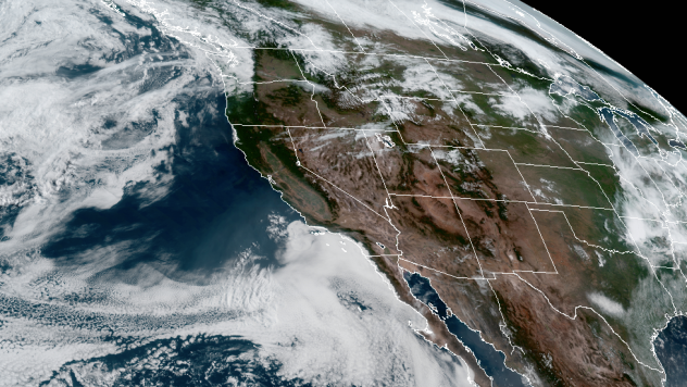
On the heels of widespread thunderstorms that rattled several areas of the United States late in the week, an outbreak of severe thunderstorms is poised to strike portions of the northern Plains and southern Canada this weekend.
The combination of a storm moving onshore in the Pacific Northwest and a strong disturbance at the jet stream height of the atmosphere, the level at which jets usually cruise, could cause thunderstorms to erupt from portions of the northern Rockies to the adjacent High Plains in Wyoming, Montana, western Nebraska and the Dakotas. The stormy weather could unfold as early as Friday night.
The storms will erupt on the northern rim of building heat to the south, and the main threat from severe weather will come during Saturday afternoon and night as strong winds aloft develop over an area where temperatures and humidity levels will surge.
"Essentially, much of the northern High Plains to portions of southern Saskatchewan and southeastern Alberta, Canada, will be at risk from later Saturday to Saturday night," AccuWeather Canada Weather Expert Brett Anderson said. Anderson has been forecasting the weather in North America for 31 years at AccuWeather.
The storms will likely bring the full spectrum of severe weather.
"Widespread heavy, gusty thunderstorms are in store, but the strongest storms can bring large hail, damaging straight-line wind gusts, flash flooding and even a few tornadoes," Anderson said.
Winds could become strong enough to knock over trees and 18-wheelers, and hail could grow large enough to break windows and destroy vehicles.
The threat of severe thunderstorms, including isolated tornadoes, will continue farther to the east over southern Manitoba, the eastern part of the Dakotas and Minnesota on Sunday.
Even though the area has had a few rounds of isolated severe thunderstorms in recent months, this has the potential to be the biggest one of the year so far in terms of the number of severe storms and the potential damaging and dangerous nature of the outbreak.
"June and July are the prime months for severe storms over the northern tier of the U.S. and the southern tier of Canada," Anderson said.
"This is because the jet stream has finally retreated to the north, and this area often represents a zone of marked temperature and humidity contrast," he explained.
This is also the season for long-lived severe thunderstorm complexes, known as derechos. These powerful storms can create hurricanelike winds for a brief time and can travel hundreds of miles in a day. The most recent derecho affected areas from Pennsylvania to New Jersey on Wednesday, with winds topping 90 mph. The damaging storms cut power to hundreds of thousands of customers in the region.
People in the area, especially those spending time outdoors or traveling, are encouraged to closely monitor the weather, including severe weather watches and warnings as they are issued. The storms could cross major highways such as Interstates 90 and 94, as well as U.S. Route 83 and Canada's Highway 1.
Cities at risk for severe storms include Bismarck and Williston, North Dakota; Rapid City and Pierre, South Dakota; Glasgow and Miles City, Montana; Gillette, Wyoming; Scottsbluff, Nebraska; and Regina, Saskatchewan.


